Rodosto Terrain turns a simple parcel drawing into a cinematic property video, branded portfolio, and full listing management system — no drone, no pilot, no weather dependency.
The Problem Every Land Agent Knows
Selling land is fundamentally different from selling a house. There are no interiors to photograph, no staged kitchens to admire. What you have is a plot of earth, a set of coordinates, and a story to tell about what surrounds it — schools, hospitals, highways, infrastructure — and what it could become.
Traditionally, the best way to tell that story was a drone flyover. But drone footage is expensive (often $200–500 per shoot), weather-dependent, requires licensed pilots, and — most critically — it shows only what the camera sees. It doesn’t annotate. It doesn’t analyze. It doesn’t adapt.
What if the map itself could generate the video?
Draw. Analyze. Present.
Rodosto Terrain is built on a single workflow:
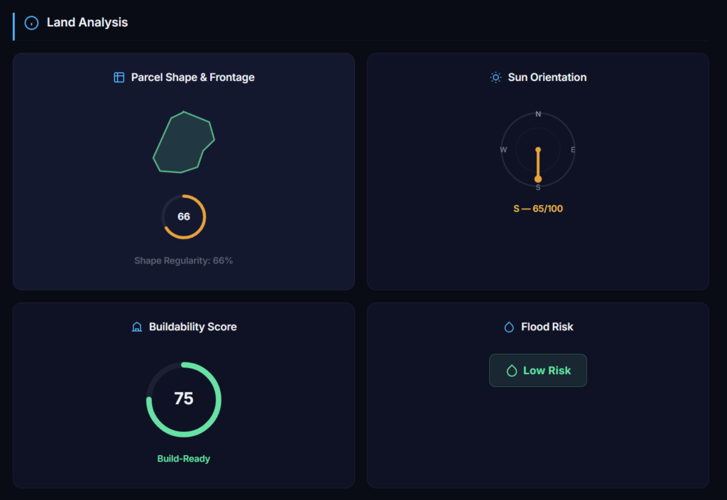
1. Draw your parcel on a 3D satellite map. Click the corner points of any land parcel on a high-resolution 3D globe (powered by ArcGIS). The platform instantly calculates area, perimeter, average elevation, slope, and aspect — no surveying equipment needed.
2. AI analyzes the surroundings. Using OpenStreetMap’s Overpass API, the system scans the area around your parcel and identifies nearby points of interest across 15+ categories: schools, hospitals, public transit, shopping, parks, mosques, highways, and more. Each POI is measured for distance and tagged.
3. A cinematic flyover video is generated automatically. This is where it gets interesting. The AI takes all of this data — the parcel geometry, the elevation profile, the surrounding POIs — and generates a multi-scene cinematic video. Each scene highlights a different property feature:
- A flyover establishing the parcel location
- An orbit revealing the terrain and slope
- Zoom-ins to nearby POIs with on-screen text annotations (“Elementary school — 350m away”)
- Sunrise/sunset lighting effects
- Branded intro and outro cards with the agent’s logo and contact information
The agent can then refine the video through a chat interface: “Show the hospital too”, “Change the music”, “Add a zoom on the main road”. The AI regenerates scenes accordingly.
4. Publish, share, embed. The finished video, along with an interactive 3D link, a PDF report, and a branded portfolio page, can be shared via link, WhatsApp, email, or embedded directly into any website.
Not a GIS Tool — A Sales Tool
It is tempting to look at the 3D map and call this a GIS platform. It is not. The 3D scene, the elevation data, the POI analysis — these are inputs to a single output: a compelling property presentation that helps agents sell land faster.
Every design decision reflects this. The parcel drawing interface is minimal — click corners, done. The analysis runs automatically — no configuration. The video is generated — not edited frame by frame. The portfolio is branded — not generic. The inquiry form routes directly to the agent’s dashboard — not to a third-party CRM.
The target user is a real estate agent with a plot of land and five minutes before the next client meeting.
What the Platform Includes
3D Map & Parcel Editor
- High-resolution 3D satellite imagery with real topography
- Click-to-draw parcel creation with auto-calculated metrics (area, slope, elevation, perimeter)
- Cadastral overlay for official parcel boundaries
- Distance measurement, sun simulation, and line-of-sight analysis
- Geocoder search for any address or location
- POI markers directly on the scene
- Map screenshot export
AI Cinematic Video Generator
- Automatic scene composition based on parcel data and surroundings
- Flyover, orbit, and zoom camera movements
- On-screen text annotations for POIs, distances, and terrain features
- Animated parcel indicator (arrow highlighting the plot)
- Agent branding: logo, contact info, custom intro/outro
- Chat-based editing interface for scene refinement
- Background music and lighting effects
Branded Portfolio Pages
- Custom logo, colors, fonts (Google Fonts), and URL slug
- Light, dark, and modern themes
- Interactive map showing all listings
- Built-in contact form with automatic inquiry routing
- Social media links
- Embeddable via iframe on any website
- Portfolio analytics: views, traffic sources, top listings
Listing Management
- Photo uploads with gallery management
- Price, area, room count, and property type fields
- Status workflow: active → sold → archived
- Filtering, sorting, and search
- Listings auto-publish to portfolio page
Customer Inquiry Tracking
- All inquiries from portfolio contact forms appear in a central dashboard
- Read/unread status tracking
- One-click reply via email or WhatsApp
- Webhook notifications for real-time CRM integration
PDF Reports
- Exportable land report with terrain score, elevation profile, slope data, surrounding infrastructure, and agent branding
- Shareable via link or direct download
For Developers: API, Webhooks & Embeds
Rodosto Terrain exposes a full developer layer for integrations.
REST API (v1)
Generate an API key from the Developer panel (rt_ prefixed, shown once). Authenticate with a single header:
X-API-Key: rt_your_key_here
Available endpoints:
| Method | Endpoint | Description |
|---|---|---|
| GET | /api/v1/listings | List parcels & properties (paginated, filterable) |
| GET | /api/v1/listings/:id | Get a specific listing |
| POST | /api/v1/listings | Create a listing programmatically |
| GET | /api/v1/portfolios | List portfolios |
Keys support scoped permissions (read, write, or *) and per-key rate limits.
Webhooks
Subscribe to events and receive real-time HTTP POST notifications:
inquiry.created— someone submitted a contact form on your portfoliolisting.created/listing.updated/listing.soldportfolio.viewed
Every payload is signed with HMAC-SHA256 (X-Webhook-Signature header). Webhooks auto-disable after 10 consecutive delivery failures.
Embed
<iframe src="https://terrain.rodostoteknoloji.com/public/portfolio/your-slug?embed=1"
        width="100%" height="600" frameborder="0"></iframe>
No authentication required. Responsive and themeable.
This means you can plug Rodosto Terrain into your existing CRM, feed listings from your database, or get notified the moment a potential buyer reaches out — all without touching the UI.
The Drone Comparison
| Drone Footage | Rodosto Terrain | |
|---|---|---|
| Cost per parcel | $200–500 | Included in subscription |
| Weather dependency | Yes | No |
| Licensed pilot required | Yes | No |
| Surrounding POI annotations | Manual post-edit | Automatic |
| Terrain analysis (slope, elevation) | Not included | Automatic |
| Agent branding | Manual post-edit | Built-in |
| Time to first video | 1–3 days | ~3 minutes |
| Editable after creation | Re-shoot required | Chat-based editing |
| Shareable portfolio | No | Yes |
Drone footage is still superior for close-range detail — construction sites, rooftop inspections, architectural showcases. But for land sales, where the value proposition is location, surroundings, and terrain characteristics, an AI-generated 3D cinematic built from real satellite data and live POI databases delivers more information in less time at a fraction of the cost.
Getting Started
- Create a free account at terrain.rodostoteknoloji.com
- Draw your first parcel on the 3D map
- Let the AI generate your cinematic video
- Publish your branded portfolio and share the link
No credit card required. No technical knowledge needed.